National Park Snaefellsjokull
Region: West IcelandCoordinates: 64.8057023° N 23.7730967° W
The Snaefellsjokull National Park was officially established on the 28th of June 2001, thus becoming the fourth national park of the country. Its boundaries follow the eastern border of the Gufuskalar estate on the northern part of the peninsula, a line east of the glacier and along the eastern edge of the Haahraun lava field to the Gjafavik cove in the south.
Within its boundaries are highly interesting geological phenomena and historical sites. According to geological findings, the volcanic drift belt crossed the Snaefells Peninsula about 6 million years ago. The volcanic activity at that time was similar to the one now experienced in the present volcanic area. Rivers, and later the ice age glaciation, carved the country and removed 500-1000 metres off the lava plateau. Intrusions of rhyolitic rock were created and sedimentation covered the base rock. Volcanic activity started again about 2 million years ago, mainly in the Ljosufjoll, the Lysuskard and Snaefellsjokull areas. This activity was unlike the earlier volcanism, because of the lack of drift and the different composition of the tephra. The Snaefellsjokull area extends from Mt. Maelifell in the east and the headland Ondverdarnes in the west.
The most obvious lava fields in the westernmost part of the peninsula are Budahraun, Hnausahraun, Klifhraun, Hellnahraun, Haahraun, Neshraun, Saxholahraun, Prestahraun and Vaejuhraun. All of them are rugged AA-lavas except Neshraun, which is a Pahoe hoe lava, created by the caters Ondverdanesholar. The lava fields Hnausahraun, Klifhraun, Hellnahraun and Vaejuhraun are probably younger than 1750 years, but the Haahraun was created by an eruption of the main crater of the Snaefellsjokull 1750 years ago.
During the earlier centuries there was much activity along the coastline. Wherever natural conditions permitted there were fishing outfits, where hundreds, if not thousands, of fishermen, who frequented the rich fishing grounds near the coast, used open rowboats. The most renowned among them is Dritvik, where the fisheries probably started in the 16th century, and according to the annals between 300 and 400 fishermen, using 60 boats, spent the time during the fishing seasons. Ruins of their abodes and a lava maze on the hill south of the cove are protected.
Other historic monuments are scattered within the national park limits, some of which are connected with legends and historic novels. Two novels have put the Snaefells Peninsula permanently on the map, Jules Verne’s novel “The Journey to the Centre of the Earth”, and Halldor Kiljan Laxness’ novel “Christianity under the Glacier”. (Picture: waterfall Klukkufoss).
According to the goal of the legislation concerning the protection of nature, emphasis is put on making the national park easily accessible for the public and the availability of information about historic and cultural sites. The staff of the national park will be able to receive school classes and other groups to educate them and take them around on sightseeing tours.
Tourism and quality services within the park are the main goals for the future. As before, individual travellers as well as groups will frequent this area, and maps with hiking trails and spots of interests will help them enjoy this remarkable part of the country to the fullest. The Nature Preservation Institute is responsible for the national park and its 5 years protection plans.
Geological Phenomena and Historical Sites
The volcanic system named after Snaefellsjokull bears witness to unique volcanic eruptions dating both from the last Ice Age and the post-glacial period. The volcanic system is about 30 kilometres long, extending from Mt. Maelifell in the east to the Ondverdarnes peninsula, in the west. At least 20 lava fields belong to the volcanic system, the lifeline of which is a magma chamber several kilometres beneath the glacier itself. The Snaefellsjokull glacier is an old strato-volcano, which has been the source of both explosive eruptions and lava eruptions. Tongues of lava, which flowed down the slopes of the mountain, can be seen in many places. Some of them reach all the way to the sea. The crater on top of the glacier is about 200 metres deep. Three peaks are on the edges of the crater, the middle one being the highest, reaching an altitude of about 1,446 metres.
Within the national park’s limits are highly interesting geological phenomena and historical sites. According to geological findings, the volcanic drift belt crossed the Snaefells Peninsula about 6 million years ago. The volcanic activity at that time was similar to the one now experienced in the present volcanic area. Rivers, and later the ice age glaciation, carved the country and removed 500-1000 metres off the lava plateau. Intrusions of rhyolitic rock were created and sedimentation covered the base rock. Volcanic activity started again about 2 million years ago, mainly in the Ljosufjoll, the Lysuskard and Snaefellsjokull areas. This activity was unlike the earlier volcanism, because of the lack of drift and the different composition of the tephra. The Snaefellsjokull area extends from Mt. Maelifell in the east and the headland Ondverdarnes in the west.
The most prominent lava fields of the westernmost part of the peninsula are Budahraun, Hnausahraun, Klifhraun, Hellnahraun, Haahraun, Neshraun, Saxholahraun, Prestahraun and Vaejuhraun. All of them are rugged AA-lavas except Neshraun, which is a Pa Hoj Hoj lava, created by the caters Ondverdanesholar. The lava fields Hnausahraun, Klifhraun, Hellnahraun and Vaejuhraun are probably younger than 1750 years, but the Haahraun was created by an eruption of the main crater of the Snaefellsjokull 1750 years ago.
During the earlier centuries there was much activity along the coastline. Wherever natural conditions permitted there were fishing outfits, where hundreds, if not thousands, of fishermen, who frequented the rich fishing grounds near the coast, used open rowboats. The most renowned among them is Dritvik, where the fisheries probably started in the 16th century, and according to the annals between 300 and 400 fishermen, using 60 boats, spent the time during the fishing seasons. Ruins of their abodes and a lava maze on the hill south of the cove are protected.
Other historic monuments are scattered within the national park limits, some of which are connected 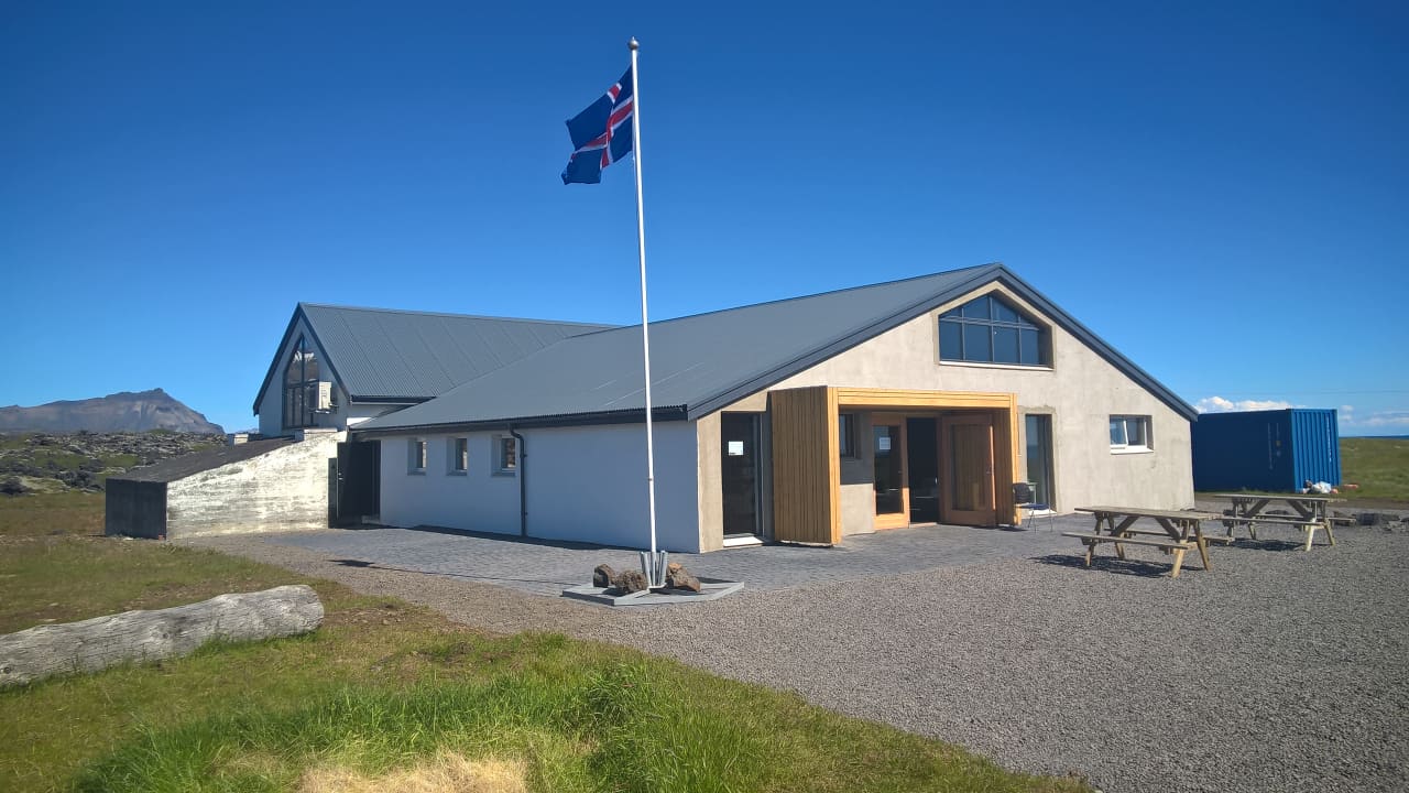 with legends and historic novels. Two novels have put the Snaefells Peninsula permanently on the map, Jules Verne’s novel “The Journey to the Centre of the Earth”, and Halldor Kiljan Laxness’ novel “Christianity under the Glacier”.
NP Snaefellsjokull
Wardens Office
open all year
Klettsbud 7
360 Hellissandur.
Travel Guide around Snaefellsnes
National Parks in Iceland
National Park Snaefellsjokull in Icelandic
Maps of Snaefellsnes area
Get an education when travel:
WHAT TO SEE?
Nearby National Park Snaefellsjokull
WHAT TO DO?
Nearby National Park Snaefellsjokull
WHERE TO STAY?
Nearby National Park Snaefellsjokull
